Exploring Terrain Indices and Slope Morphometry for Trail and Campsite Planning on Mount Irau, Malaysia

Article Sidebar
-
Landform, Mount Irau, Recreation planning, Terrain analysis, sustainable
Abstract
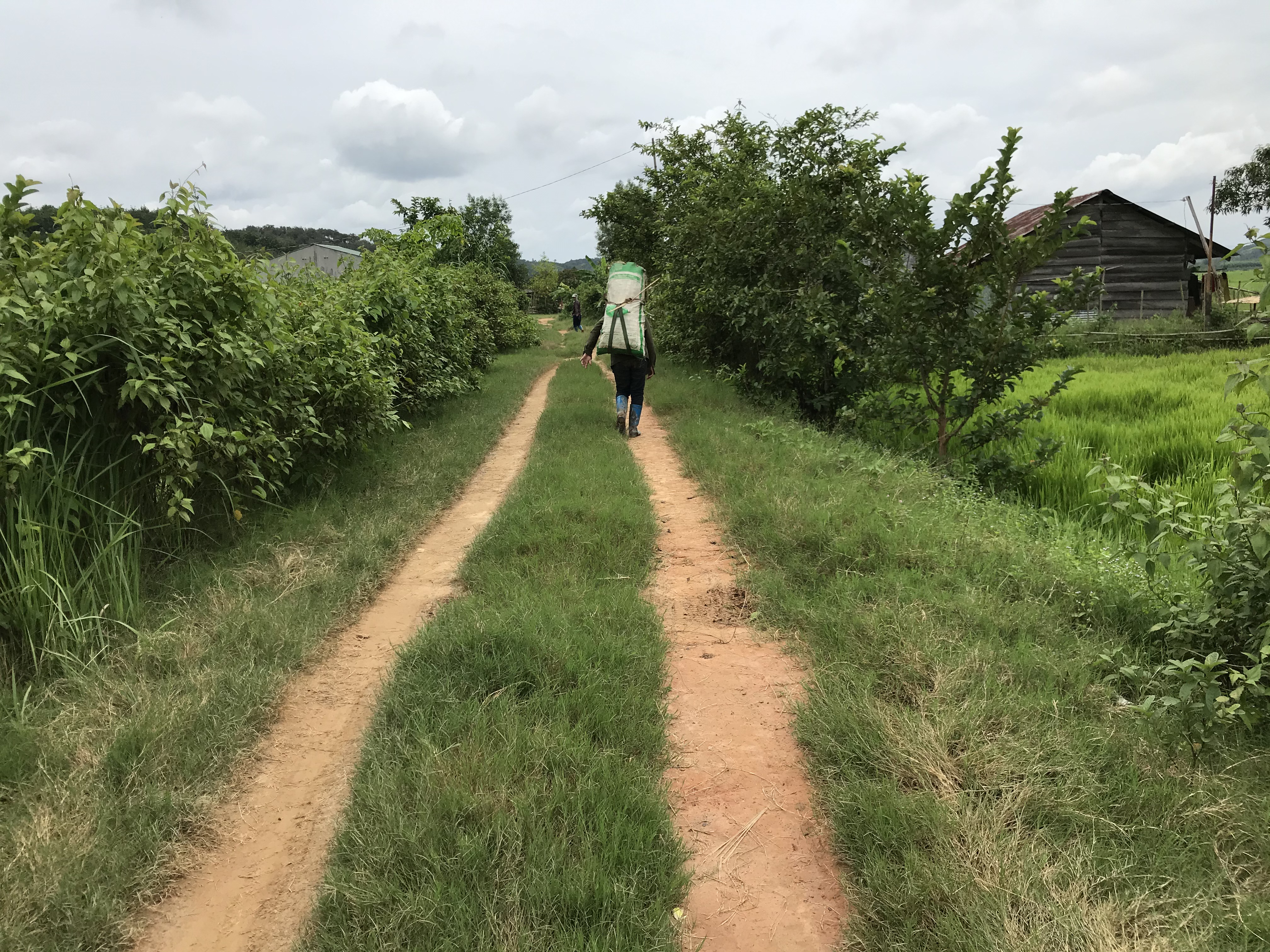
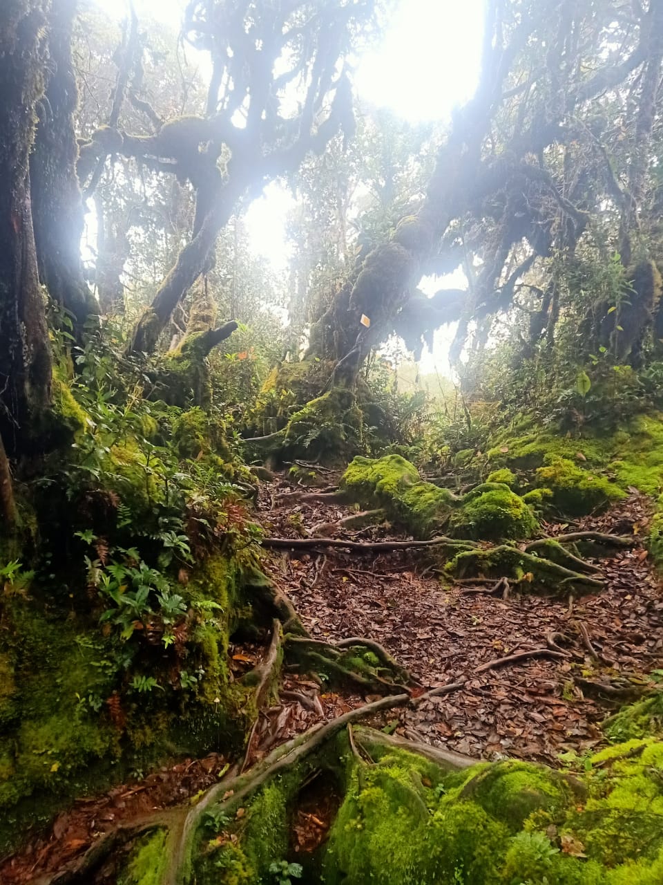
Terrain analysis and elevation profiling are widely utilized in geographical studies where spatial information system is one of the foremost tools in assessing characteristic patterns of hiking trails and plain areas suitable for a campsite. The main objective of this study is to classify the landforms of Batu Gangan Forest Reserve by conducting a morphometric analysis of the Digital Elevation Model (DEM) with 10m resolution. The classification process is based on calculating the Topographic Position Index (TPI). Using TPI, the landscape was classified into slope position and landform categories. The delivered TPI landform classes are spatially correlated with the elevation, slope, LS factor, and topographic wetness of the mountain. Site observation was carried out to identify water sources, viewpoints, and their significance as suitable campsites and potential trail. An alternative trail was proposed to reduce the visitor impacts towards the main trails. The result suggested that the plains landform only covered 3.26% or 2.03km2 of the study area, where two potential campsites were identified. The method presented and research findings derived from the study are beneficial to support sustainable recreation resource planning, especially in a complex mountainous area. The study's findings and data will lead to proper forest use for recreational reasons consistent with conservation efforts.
References
Becco, J. A., Hallo, J., Manning, R. E., Akers, J., Duh, S., Smith, C., ..., & Leung, Y. F. (2016). GIS applications. In J. Bass, & R. C. Burns (Eds.), Outdoor recreation planning (pp. 93–112). Sagamore Publishing.
Cesetti, A., Frontoni, E., Mancini, A., Zingaretti, P., & Longhi, S. (2010). A vision-based guidance system for UAV navigation and safe landing using natural landmarks. Journal of Intelligent and Robotic Systems, 57, 233. https://doi.org/10.1007/s10846-009-9373-3
Choi, K. -Y., & Dawson, C. P. (2002). Attributes affecting campsite selection at two types of campgrounds in the Adirondack Park. Proceedings of the 2002 Northeastern Recreation Research Symposium (pp. 94–101). http://www.nrs.fs.fed.us/pubs/gtr/gtr_ne302/gtr_ne302_094.pdf
Cole, D. N., & Monz, C. A. (2003). Impacts of camping on vegetation: Response and recovery following acute and chronic disturbance. Environmental Management, 32(6), 693–705. https://doi.org/10.1007/s00267-003-0046-x
Cone, J. (1998). Principles of geographical information systems by Peter A. New Zealand Geographer, 54(2), 56–57. https://doi.org/10.1111/j.1745-7939.1998.tb02089.x
Conrad, O. (2006). SAGA-program structure and current state of implementation. In J. Böhner, K. R. McCloy, & J. Strobl (Eds.), SAGA-analysis and modelling applications. Göttinger Geographische Abhandlungen 115 (pp. 39–52).
Costa, D. M. da, & Souza, E. R. (2018). Conceptions of mountain formation, folding, fault and the continental drift in geography textbooks between the decades of 1930 to 1960. Terrae Didatica, 14(4), 349–354. https://doi.org/10.20396/td.v14i4.8654094
Department of Environment and Science, Queensland. (2020). Terrain slope. WetlandInfo. https://wetlandinfo.des.qld.gov.au/wetlands/ecology/aquatic-ecosystems-natural/estuarine-marine/itst/terrain-slope/
Department of Sustainability and Environment, Victoria. (2011). Users guide to the Australian walking track grading system.
Forest Practice Code of Bristish Colombia (1999). Mapping and assessing terrain stability guidebook (2nd ed.). Bristish Colombia.
Grohmann, C. H., Smith, M. J., & Riccomini, C. (2009). Surface roughness of topography: A multi-scale analysis of landform elements in Midland Valley, Scotland. Proceedings of Geomorphometry, 2009, 140–148.
Guisan, A., Weiss, S. B., & Weiss, A. D. (1999). GLM versus CCA spatial modeling of plant species distribution. Plant Ecology, 143, 107–122. https://doi.org/10.1023/A:1009841519580
Hung, I , K. (2002). Using GIS for forest recreation planning on the longleaf ridge special area of the Angelina National Forest, East Texas [dissertation]. Texas: Stephen F. Austin State University.
Hutchinson, M. F. & Gallant, J. C. (2000). Digital elevation models and representation of terrain shape. In J. P. Wilson, & J. C. Gallant (Eds.), Terrain analysis. (pp. 29–49). John Wiley.
Ilia, I. K., Rozos, D. E., & Koumantakis, I. (2013). Landform classification using GIS techniques. The case of Kimi Municipality area, Euboea Island, Greece. Bulletin of the Geological Society of Greece, 47(1), 264–274.
Kumaran, S., Perumal, B., Davison, G., Ainuddin, A. N., Lee, M. S., & Bruijnzeel, L. A. (2011). Tropical montane cloud forests in Malaysia: Current state of knowledge. In L. A. Bruijnzeel, F. N. Scatena, & L. S. Hamilton (Eds.), Tropical montane cloud forests science for conservation and management (pp. 113–120). Cambridge University Press https://doi.org/10.1017/CBO9780511778384.011
Leung, Y. F., & Marion, J. L. (1996). Trail degradation as influenced by environmental factors: A state-of-the-knowledge review. Journal of Soil and Water Conservation, 51(2), 130–136.
Leung, Y. F., & Marion, J. L. (2004). Managing impacts of camping. In R. Buckley (Ed.), Environmental impacts of ecotourism (pp. 245–258). CABI Publishing. https://doi.org/10.1079/9780851998107.0245
Leung Y. F., & Monz, C. (2006). Visitor impact monitoring. The George Wright Forum, 23(2), 7–10.
Marion, J. L., Wimpey, J., Arredondo, J., & Meadema, F. (2020). Sustainable camping "Best management practices". U.S. Geological Survey, Virginia Tech Field Unit.
McVicar, T. R., & Körner, C. (2013). On the use of elevation, altitude, and height in the ecological and climatological literature. Oecologia, 171(2), 335–337. https://doi.org/10.1007/s00442-012-2416-7
Meadema, F. (2019, March 19–21). The influence on layout on degradation of the Appalachian Trail [Conference presentation]. Sustainable Trails Conference, Grand Junction, Colorado, United States. Retrieved from https://drive.google.com/file/d/13BHtDb9L5QIy3RzE8x8-vLl9E3bJ6BuQ/view
Ming, P. L. H., & Zawawi, A. A. (2020). Mapping potential landslide using digital terrain model: Application in Ringlet Forest Reserve. The Malaysian Forester, 83(1), 28–37.
Mokarram, M., Seif, A., & Sathyamoorthy, D. (2015). Landform classification of Zagros Mountains using multiscale analysis of digital elevation models. Malaysian Journal of Remote Sensing & GIS, 4(1), 30–48.
Muntasib, E. K. S. H., Nadhira, F., & Meilani, R. (2019). Hazard management in tourism: A case study of the Senaru-Sembalun Hiking Trail, Mount Rinjani National Park, Indonesia. Jurnal Manajement Hutan Tropika, 25(3), 199–208. https://doi.org/10.7226/jtfm.25.3.199
North Country National Scenic Trail. (1996). A handbook for trail design, construction, and maintenance. United States Department of the Interior.
Olafsdottir, R., & Runnstrom, M. C. (2013). Assessing hiking trails condition in two popular tourist destinations in the Icelandic highlands. Journal of Outdoor Recreation and Tourism, 3-4, 57–67. https://doi.org/10.1016/j.jort.2013.09.004
Pradhan, B., & Buchroithner, M. (Eds.). (2012). Terrigenous mass movements: Detection, modelling, early warning and mitigation using geoinformation technology. Springer. https://doi.org/10.1007/978-3-642-25495-6
Reli, S. N., Yusoff, I. M., & Ujang, M. U. (2021). Slope stability estimation using danger level approach for monitoring landslide prone areas. Geografia, 17(4), 221–239. https://doi.org/10.17576/geo-2021-1704-16
Rigol-sanchez, J. P., Stuart, N., & Pulido-bosch, A. (2015). Computers & geosciences ArcGeomorphometry: A toolbox for geomorphometric characterisation of DEMs in the ArcGIS environment. Computers and Geosciences, 85, 155–163. https://doi.org/10.1016/j.cageo.2015.09.020
Saadat, H., Bonnell, R., Sharifi, F., Mehuys, G., Namdar, M., & Ale-Ebrahim, S. (2008). Landform classification from a digital elevation model and satellite imagery. Geomorphology, 100(3–4), 453–464. https://doi.org/10.1016/j.geomorph.2008.01.011
Skentos, A. (2017). Topographic position index based landform analysis of Messaria (Ikaria Island, Greece). Acta Geobalcanica, 4(1), 7–15. https://doi.org/10.18509/agb.2018.01
Skentos, A., & Ourania, A. (2017). Landform analysis using terrain attributes. A GIS application on the Island of Ikaria (Aegean Sea, Greece). Annals of Valahia University of Targoviste, Geographical Series, 17(1), 90–97. https://doi.org/10.1515/avutgs-2017-0009
Sonti, S. H. (2015). Application of geographic information system (GIS) in forest management. Journal of Geography and Natural Disasters, 5(3), 1000145. https://doi.org/10.4172/2167-0587.1000145
Stage, A. R. & Salas, C. (2007). Interactions of elevation, aspect, and slope in models of forest species composition and productivity. Forest Science, 53(4), 486–492. https://doi.org/10.1093/forestscience/53.4.486
Tagil, S., & Jenness, J. (2008). GIS-based automated landform classification and topographic, landcover and geologic attributes of landforms around the Yazoren Polje, Turkey. Journal of Applied Sciences, 8(6), 910–921. https://doi.org/10.3923/jas.2008.910.921
Verhagen, P., & Drâguţ, L. (2012). Object-based landform delineation and classification from DEMs for archaeological predictive mapping. Journal of Archaeological Science, 39(3), 698–703. https://doi.org/10.1016/j.jas.2011.11.001
Vukomanovic, J., Walden-Schreiner, C., Hipp, J. A., & Leung, Y. -F. (2022). GIS & T and recreation planning and management. In J. P. Wilson (Ed.), The geographic information science & technology body of knowledge (1st Quarter 2022 Edition). https://doi.org/10.22224/gistbok/2022.1.8
Warner, G. S., Nieber, J. L., Moore, I. D., & Geise, R. A. (1989). Characterizing macropores in soil by computed tomography. Soil Science Society of America Journal, 53(3), 653–660. https://doi.org/10.2136/sssaj1989.03615995005300030001x
Weiss, A. D. (2001). Topographic position and landforms analysis [Poster presentation]. ESRI User Conference, San Diego, CA, United States.
Williams, P. B., Marion, J.L. (1995). Assessing campsite conditions for limits of acceptable change management in Shenandoah National Park. USDI National Biological Service, Virginia Tech Cooperative Park Studies Unit.
Wilson, & Gallant. (2000). Digital terrain analysis in terrain analysis: Principles and applications. John Wiley & Sons.
Zalina, M. S. (2020, August 20). #JOM! GO: Dreamy trek through Mossy Forest. New Straits Times. https://www.nst.com.my/lifestyle/jom/2020/08/617972/jom-go-dreamy-trek-through-mossy-forest
Zawawi, A. A., Shiba, M., & Jemali, N. J. N. (2014). Landform classification for site evaluation and forest planning: Integration between scientific approach and traditional concept. Sains Malaysiana, 43(3), 349–358.
Authors

This work is licensed under a Creative Commons Attribution 4.0 International License.
Jurnal Manajemen Hutan Tropika is an open access journal which means that all contents is freely available without charge to the user or his/her institution. Users are allowed to read, download, copy, distribute, print, search, or link to the full texts of the articles in this journal without asking prior permission from the publisher or the author. This is in accordance with the Budapest Open Access Initiative (BOAI) definition of open access.Article Details